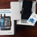
[Jual Gps Garmin Etrex] Jual Gps Garmin Etrex 30, Etrex 10, Imron
- Dipasang1 Oktober 2012
- Harga3.100
- Kotajakarta barat
- KondisiBaru
( 02195848112 / 02149118823) Jual Gps Garmin 76csx, Jual Gps Garmin 78s, Jual Gps Garmin 62s,
Jual Gps Garmin Etrex 10, Jual Gps Garmin Etrex 20, Jual Gps Garmin Etrex 30, Jual Gps Garmin
Oregon 550, Jual Gps Garmin Montana 650, Jual Gps Garmin Aera 500, Dll.
eTrex 30
Kategori: GPS Devices > Mapping Handheld
Paperless Geocaching
Spend more time in the field and less time fumbling with paper! The eTrex stores and displays key information, including location, terrain, difficulty, hints and descriptions, which means no more manually entering coordinates and paper print outs. Simply upload the geocaching GPX file to your unit and start hunting for caches.
Track More Satellites
Find your way with the first consumer-grade GPS receiver that tracks both GPS and Russian Federation GLONASS satellites simultaneously. When using them together, the receiver has the ability to lock onto 24 more satellites than using GPS alone, ensuring you can “lock on” to a position more quickly.
Pick Your Profile
Customize eTrex for every occasion. Profiles allow eTrex to quickly switch into different configurations that you create, so when you’re done geocaching and you need to drive home, your eTrex won’t miss a beat.
More Dashboards in More Places
Bring more functionality into your frequently used applications with dashboards. Avoid switching between applications and display more information by customizing them with an altimeter, compass, configurable data fields and more.
Advanced Tracking
Whether following a saved route or planning a new one, eTrex has the tracking features you need. Users can see high and low elevation points or store waypoints along a track (start, finish and high/low altitude) to estimate time and distance between points.
Extensive Map Support
With its microSD™ card slot and large internal memory, eTrex lets you load a variety of maps, including TOPO 24K, BlueChart® g2, City Navigator NT® and BirdsEye™ Satellite Imagery (subscription required).
Spesifications:
Physical & Performance:
Unit dimensions, WxHxD: 2.1" x 4.0" x 1.3" (5.4 x 10.3 x 3.3 cm)
Display size, WxH: 1.4" x 1.7" (3.5 x 4.4 cm); 2.2" diag (5.6 cm)
Display resolution, WxH: 176 x 220 pixels
Display type: transflective, 65-K color TFT
Weight: 5 oz (141.7 g) with batteries
Battery: 2 AA batteries (not included); NiMH or Lithium recommended
Battery life: 25 hours
Waterproof: yes (IPX7)
Floats: no
High-sensitivity receiver: yes
Interface: USB
Maps & Memory:
Basemap: yes
Preloaded maps: no
Ability to add maps: yes
Built-in memory: 1.7 GB
Accepts data cards: microSD™ card (not included)
Waypoints/favorites/locations: 2000
Routes: 200
Track log: 10,000 points, 200 saved tracks
Features & Benefits:
Automatic routing
(turn by turn routing on roads):
yes (with optional mapping for detailed roads)
Electronic compass:
yes (tilt-compensated, 3-axis)
Touchscreen:
no
Barometric altimeter:
yes
Camera:
no
Geocaching-friendly:
yes (paperless)
Custom maps compatible:
yes
Photo navigation (navigate to geotagged photos):
yes
Outdoor GPS games:
no
Hunt/fish calendar:
yes
Sun and moon information:
yes
Tide tables:
yes
Area calculation:
yes
Custom POIs (ability to add additional points of interest):
yes
Unit-to-unit transfer (shares data wirelessly with similar units):
yes
Picture viewer:
no
Garmin Connect™ compatible (online community where you analyze, categorize and share data):
yes
What's in the Box:
eTrex 30
USB cable
Manual
UNTUK PEMESANAN HUBUNGI:
CV.SURVEYINGSTORE.NET
Jl.P KOMPLEK DKI BLOK H/3 JAKARTA BARAT
TLP : 021-95848112 / 021-94970600 / 021-95476927
HP : 085695545786 / 087875031222
KONTAK: muhamad imron
EMAIL : muhamadimron373@yahoo.com
WEB : www.surveyingstore.net
Ym : muhamadimron373@yahoo.com
CALL : (021) 95848112 / MUHAMAD IMRON
- Nama:muhamad imron
- Username:store80
- Reputasi:
- Terdaftar :20-09-2012
- Status:

- Telp:0219-XXXX-XXXX Lihat
- HP:0856-XXXX-XXXX Lihat
- Cek Penipu atau Bukan
- YM:
- Alamat:Jl.HOS Cokroaminoto Ciledug Raya Larangan Utara
- Kota:Tangerang
- Provinsi:Banten
Jual Berbagai Macam Gps Garmin, Telepon Satelit, Alat Geologi Dan Alat Survey
- Kunjungi Tips Belanja Aman
- Jangan tergiur harga murah, usahakan tidak melakukan transer langsung.
- Gunakan rekening bersama. Lebih baik kehilangan uang 5 atau 10.000 daripada tertipu.
Related Products
40.000
12.000.000
4.000.000
4.200.000
4.500.000
Produk
4.000.000
3.000.000
5.000
5.000
36.000
![[Jual Gps Garmin Etrex] Jual Gps Garmin Etrex 30, Etrex 10, Imron - Handphone & PDA Lainnya](/img/mobilbekas.png)
![[Jual Gps Garmin Etrex] Jual Gps Garmin Etrex 30, Etrex 10, Imron [Jual Gps Garmin Etrex] Jual Gps Garmin Etrex 30, Etrex 10, Imron](http://img.mobilbekas.web.id/1/6/16767/thumb/20121001G.Echo_Series.jpg)


Leave Comment