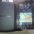
GPS GARMIN Aera 795 (081289854242)
- Dipasang4 Agustus 2016
- Harga123
- KotaTangerang Selatan
- MerkGarmin
- KondisiBaru
Spesifikasi – Garmin Aera 795
Physical & Performance
Unit dimensions, WxHxD 5.1 ” W x 8.0 ” H x 1.5 ” D ( 13.0 x 20.3 x 3.8 cm)
Display size, WxH 3.6 ” W x 6.0 ” H ( 9.1 x 15.2 cm) ; 7.0 ” diag ( 17.78 cm)
Display resolution, WxH 480 x 800 pixels
Display type dual-oriented, bright, color WVGA TFT with adjustable backlighting and selectable screen orientation
Weight 26.4 ounces ( 748 g) with battery pack; 18.3 ounces ( 519 g) without battery pack; 12.7 ounces ( 361 g) RAM mount
Battery rechargeable, replaceable Lithium-ion
Battery life up to 3 hours with full backlight and GXM 40 connected ( 8 hours with 50% backlighting and XM connected)
Waterproof No
Voltage range 11-40
SBAS/ WAAS receiver high-sensitivity with WAAS position accuracy
IFR or VFR VFR
Maps, Databases & Memory
Basemap Yes
Navigation database ( includes Jeppesen ® data) Yes
Types of Jeppesen data full and ARTCC, FSS frequencies and final approach waypoints
Navigation database coverage areas Americas
Preloaded Terrain database Yes
Preloaded Obstacle database Yes ( U.S. and Europe only)
Preloaded SafeTaxiâ „ ¢ airport diagrams Yes ( U.S. only)
Preloaded AOPA Airport Directory Yes ( U.S. only)
Preloaded Garmin FliteCharts ® Yes ( U.S. only)
Preloaded low & high altitude enroute airways Yes
Preloaded private airports Yes ( U.S. only)
Preloaded street maps No
Ability to add maps Yes
Accepts data cards yes ( SD cards)
Built-in memory internal solid state
Waypoints/ favorites/ locations 3, 000
Routes 50
Features & Benefits
Moving map Yes
Patented panel page Yes
HSI ( GPS-based) Yes
IFR map mode Yes
Traffic Information Services ( TIS) alerts compatible Yes
Audible terrain alerts Yes
Terrain resolution standard
Smart Airspace Feature ( generates and displays altitude-sensitive alerts) Yes
Automatic logbook Yes
Separate serial and USB interfaces Yes
Voice prompts ( e.g. ” Turn right in 500 ft. ” ) No
Speaks street names ( e.g. ” Turn right ON ELM STREET in 500 ft. ” ) No
Lane assist ( guides to proper lane for navigation) No
3-D map view No
Bluetooth ® wireless technology no
Speed limit indicator ( displays speed limit for most major roads in the U.S. and Europe) No
Traffic compatible ( routes around traffic with a receiver and subscription) No
Custom POIs ( ability to add additional points of interest) No
XM WX Weather & Radio for U.S. & Canada compatible No
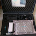
In The Box :
aera 795
Yoke mount
DC cigarette adapter 12/ 24 volt cradle
Home A/ C cradle dock
GA 25 remote antenna with suction cup mount
USB cable
Carrying case
Touchscreen cleaning cloth
Quick reference guide
Complimentary single database update
Pilot’ s Guide e-version ( viewable on the document viewer)
Nusatama Store
GPS,Alat Survey,Alat Geologi,Telepon Satelit, Perahu Karet
Jl.H.Sapri No.32 Pondok Aren
Tangerang Selatan – 15224
Sales : Ambar
Hp : 0812-8985-4242 / 0817-675-5161
Pin BB : 277F253D / 2BC8CF8F
KAMI MELAYANI PEMESANAN KESELURUH KOTA-KOTA DI INDONESIA,
Surabaya, Bali, Sidoarjo, Malang, Semarang, Yogyakarta, Pekalongan, Cirebon, Tangerang, Jakarta, Bandung, Sumatra, Aceh, Lampung, Medan, Riau, Batam, Jambi, Padang, Kalimantan, Samarinda, Pekanbaru, Bengkulu, Makasar, Sulawesi, Irian jaya,Papua, Bangka Belitung, Banten, Jabar, Jateng, Jatim, Ntt, Ntb, Gorontalo, maluku DLL
Pengiriman Untuk Kota Jakarta Gratis. Luar Jakarta dgn layanan JNE YES TIKI MEX Berlian Dirgantara
- Nama:Nusatama Store
- Username:nusatamastore
- Reputasi:
- Terdaftar :04-08-2016
- Status:

- Telp:0817-XXXX-XXXX Lihat
- HP:0812-XXXX-XXXX Lihat
- Cek Penipu atau Bukan
- YM:
- Alamat:Jl.H.Sapri No.32 Pondok Aren Tangerang Selatan
- Kota:Tangerang Selatan
- Provinsi:Banten
Nusatama Store
juga menyediakan jual berbagai produk
– Alat Geologi – Alat Laboratorium
– Alat Tuluis Survey – Alat Ukur, Arus Air/angin
– Automatic Level/Water Pas – Camera
– Kompas/Klinometer/Altimeter
– Digital Theodolite – Drone
– GPS – Hammer Test
– Perahu Karet – plotter
– Radio Komunikasi – Telepon Satelit
– Teropong – Test & Measurement
– Total Station
– Weather Station
Sales : Ambar
Hp : 0812-8985-4242 / 0817-675-5161
Pin BB : 277F253D / 2BC8CF8F
- Kunjungi Tips Belanja Aman
- Jangan tergiur harga murah, usahakan tidak melakukan transer langsung.
- Gunakan rekening bersama. Lebih baik kehilangan uang 5 atau 10.000 daripada tertipu.
Related Products
6.500.000
2.950.000
6.500.000
34.000
12.000
Produk
4.300.000
140.000.000
185.000.000
210.000.000
40.000.000

Leave Comment